Chicago - City of Big Shoulders

Chicago - City of Broad Shoulders


This course is about Chicago, We will cover the history of the city and region, the politics, corruption, arts, plans, neighborhoods, humor, achievements and the future of the City.

Geography and Glaciers


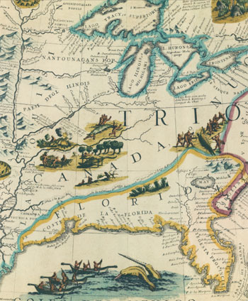
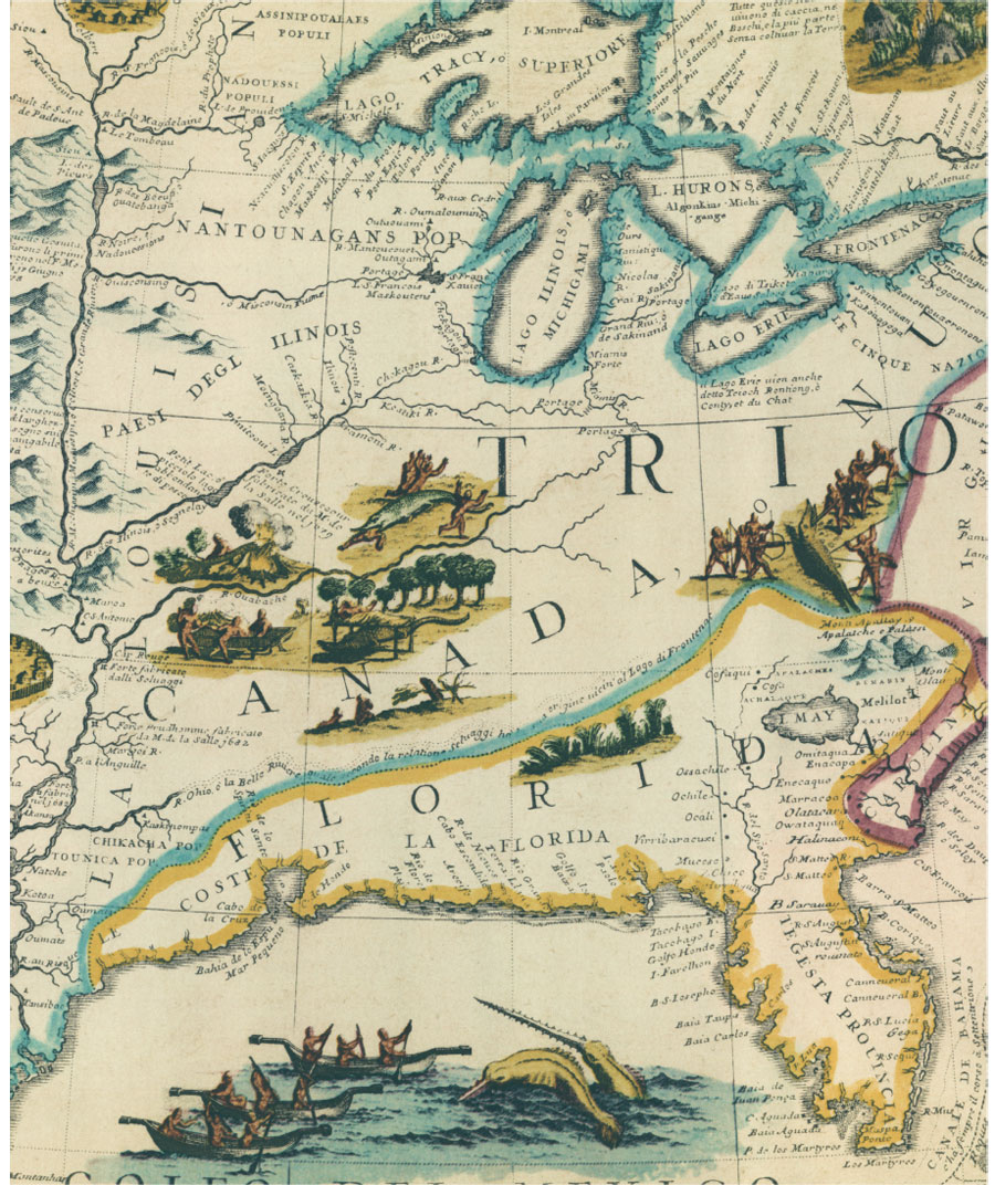
Chicago's geography resulted from the action of large glaciers during the Ice Age which created Lake Michigan.  The Chicago region is a flat plain that was the bottom of the ancestral Lake Chicago.

The Glacier over Lake Michigan was approximately one mile high. It formed a very large river valley along the Des Plaines and Illinois Rivers when it melted.  At one point the Glacier blocked the Mississippi River and the Chicago / Desplaines/ Illinois Rivers drained the melting waters of the Glacier, resulting in a very wide river valley. 

The highest point within the city limits is in the Beverly neighborhood. This ridge was called Blue Island because it looked like an island set in the prairie.  

When Chicago was founded the land was a swamp. It took a major effort to raise the grade of buildable areas and create storm and sanitary sewers to drain the region.


City limits of Chicago

A very large limestone quarry has been excavated south of the city in Thornton.  The Thornton quarry was a coral reef when the area was covered by a sea many millions of years ago. 


  1. Geography of Chicago - Wikipedia, the free encyclopedia

    en.wikipedia.org/wiki/Geography_of_Chicago
    Chicago's present natural geography is a result of the large glaciers of the Ice Age, namely the Wisconsinan Glaciation that carved out the modern basin of Lake ...
  2. Glacial Lakes - Department of Geography - Michigan State University

    www.geo.msu.edu/geogmich/glacial.html
    Initially, excess water from Glacial Lake Maumee flowed southwest to the Wabash River, and Glacial Lake Chicago drained west and south by way of the ...
  3. Glaciers - An Overview of Glaciers - Geography - About.com

    geography.about.com/od/geographyintern/a/glaciers.htm
    A comprehensive overview of glaciers. Includes the types of glaciers, how glacierscarve the land, and the importance of glaciers. From Colin Stief of Geography ...

  4. The Elementary School Teacher and the Course of Study - Volume 3 - Page 573 - Google Books Result

    books.google.com/books?id=GDUVAAAAIAAJ
    University of Chicago. Dept. of Education, University of Chicago. Graduate School of Education - 1903 - Education, Elementary
    Hills, valleys, and plains — due to glaciers. Contributions of glaciers to the localgeography of Chicago. (Study of work of glaciers at Cary, Glencoe, and Stony ...

  5. Bulletin of the Geographic Society of Chicago - Issue 1 - Page 19 - Google Books Result

    books.google.com/books?id=C94bAAAAMAAJ
    Geographic Society of Chicago - 1920 - Geography
    Geographic Society of Chicago. been called interglacial. During the glacial epochs the climate was severe, and the ice-sheets were enlarged; during the ...
  6. Geography of Palos Hills, Illinois

    www.liskahaas.org/stagg/palosgeography.htm
    Geography of Palos Hills, Illinois ... That extensive area of water was called glacialLake Chicago. It is right here in the Palos area where the moraines broke and ...
  7. BBC - GCSE Bitesize - Glacial landscapes and processes

    www.bbc.co.uk › Home › Geography
    A secondary school revision resource for GCSE Geography on the topic of glaciallandscapes and processes, glacial deposition and erosion.
  8. What role did glaciers play in shaping the physical geography of ...

    www.chacha.com › Categories › Society & Culture
    Chicago's present natural geography is a result... 436 days ago. What is the role ofGlacier Park International Airport? Glacier Park International Airport is loacted ...
  9. Chicago Geology - Faculty Home

    faculty.ccc.edu/jtassin/.../Chicagogeo/chicagogeology.htm
    In the Chicago region, glacial melt was dammed first by the Lake Border Moraine. ...Another major change in the geography of Chicago occurred with the in ...


Location, Location, Location

Why has Chicago grown so rapidly?  Location, Location, Location. The map below shows water way links in the United States.  Chicago is near the south end of Lake Michigan. 

The Great Lakes provide a great water way to transport people and cargo around the Lakes and down the St Lawrence River to the Atlantic Ocean. This was important to the Native Americans and French, and it is important today.

And the Great Lakes were only a short portage to the DesPlaines River connecting to the Illinois River and then the Missississipi. So a very large portion of North America was connected by water, with Chicago in the central Hub.


Lake Michigan and the Great Lakes also form a very large barrier.  All the trails and later roads and railroads north of the south end of Lake Michigan had to move to the south to get around Lake Michigan.


All Roads Lead to Chicago - Or at Least a Lot of Them do


A Busy Crossroads

Vincenzo Coronelli, detail of globe gore showing eastern North America (Venice, 1688?). Hermon Dunlap Smith Collection, The Newberry Library
Chicago's role as a continental crossroads came from its location linking two great navigable water systems. To the east, the waters of the Great Lakes flowed out the St. Lawrence River to the Atlantic Ocean; to the west and south, the Illinois River flowed into the Mississippi River and the Gulf of Mexico. Native Americans and early European explorers understood this, as the 17th-century map shows. Connection between the two water systems was initially made by a short and easy portage over land from the South Branch of the Chicago River to the Des Plaines River. In 1848, the new Illinois and Michigan Canal provided an all-water connection between the Chicago and the Illinois rivers, solidifying Chicago's strategic position.


Paleo Indians - First Chicagoans

10000-8000 BC Paleo Indians roam the area 

8000-500 BC Archaic Indians inhabit forests, hunt deer and small game use stone tools

500 BC-900 AD Woodlands Indians grow maize, build villages and burial mounds

900-1500 AD Misissippian culture improve agricultural methods 


Search Results


  1. Chicago history: Paleo-Indians - Chicago History | Examiner.com

    www.examiner.com/article/chicago-history-paleo-indians‎


    Feb 11, 2013 – The first human beings, also called Clovis People, migrated to theChicago area after the Laurentide Ice Sheet withdrew around 10000 years ...

  2. Paleo-Indians - Wikipedia, the free encyclopedia

    en.wikipedia.org/wiki/Paleo-Indians‎

    Paleo-Indians (Paleoindians) or Paleoamericans is a classification term given to the first peoples who entered, and subsequently ..... University of Chicago. 1958 ...

  3. Paleo-Indians settled North America earlier than thought, study ...

    www.eurekalert.org/pub_releases/2011-03/uoia-psn031711.php‎

    Mar 24, 2011 – Earth scientists at the University of Illinois at Chicago determined the age ... younger, previously dated Paleo-Indian Clovis-culture artifacts.

  4. Paleo-Indian culture -- Encyclopedia Britannica

    www.britannica.com/EBchecked/topic/439369/Paleo-Indian-culture‎

    Paleo-Indian culture. ... Although most of the routes used by the Paleo-Indians are difficult to investigate because they are now under water or deeply buried or ...

  5. What does paleo-indian mean? - Definitions.net

    www.definitions.net/definition/paleo-indian‎

    Style:MLAChicagoAPA. "paleo-indian." Definitions.net. STANDS4 LLC, 2013. Web. 13 May 2013. <http://www.definitions.net/definition/paleo-indian>.

  6. Paleoindian - Bama.Ua.Edu

    bama.ua.edu/~alaarch/prehistoricalabama/paleoindian.htm‎

    Small, nomadic groups of people, known as Paleoindians, were some of the first humans to live in Alabama as early as 11,000 B.C. They hunted megafauna ...
  7. Images for paleo indians chicago

     - Report images

  8. paleo-indians - WBEZ

    www.wbez.org/tags/paleo-indians‎

    Mar 24, 2011 – WBEZ 91.5 Chicago ... Subscribe to paleo-indians ... previously thought, and a Chicago researcher played a key role in nailing down the dates.

  9. Paleo Indian stone totem figurine art - Ice-Age Indian Art

    www.iceageartifacts.com/paleo_indian_art.htm‎

    Note Middle Devonian deposits (dark purple) in the northeast (Chicago) region. These Paleo Indian artifact stones hold Devonian fossils 354 million years old ...
  10. [PDF]

    Paleoindian Biblio Annotated - The University of Iowa

    www.uiowa.edu/~osa/IAM/Resources/PaleoBiblio.pdf‎

    Oct 1, 2004 – A short, illustrated summary of Paleo-Indian times in New England. While many of ... Chicago: University of Chicago Press, 2002. Cohen tells ...

  11. Paleo-Indians - DiscoverSEAZ

    www.discoverseaz.com/History/PaleoInd.html‎

    Paleo-Indians hunted in southeastern Arizona more than 10000 years ago.


Native American Trails


There were numerousNative American trails leading to Chicago. The most important means of transportation was canoes in the Great Lakes and on the rivers.

Trails interconnected areas not on the waterways. Sauk Trail was a Native American trail running through Illinois, Indiana and Michigan. The trail ran from Rock Island on the Mississippi River to the Illinois River near modern Peru, Illinois, then along the north bank of that river to Joliet, and on to Valparaiso, Indiana. Then it ran northeasterly to LaPorte and into southern Michigan running through Niles,Three Rivers, Ypsilanti and ending at the Detroit River near Detroit.The trail followed a winding path around natural topography including following the ridges of dune and moraines that mark the earlier glacial period Lake Michigan shorelines. European settlers improved the trail into a wagon road and later into modern highways, although these often have been straightened and rerouted.
  1. [PDF]

    INDIAN TRAILS OF CHICAGO - Chicago History Museum

    www.chicagohistory.org/static_media/pdf/historyfair/indian_trails.pdf‎

    INDIAN TRAILS OF CHICAGO. Reference. qF38AP. Indian Trail markers. C38. InChicago, v. 1, no. 11, p. 54-55, Jan. 1955. v.1. F383D. S492. Shapiro, Dena ...
  2. Sauk Trail - Wikipedia, the free encyclopedia

    https://en.wikipedia.org/wiki/Sauk_Trail‎

    Later traders and their Indian suppliers would continue to use the trail. ... The surveying for this Chicago Road began in 1825 but financial shortfalls led to a ...
Newer Posts Older Posts Home
Subscribe to: Posts (Atom)

Search This Blog

Table of Contents

Early History

  • Introduction

  • Table of Contents

  • Glaciers and Geography

  • Location, Location, Location

  • Paleo Indians - First Chicagoans

  • Native American Trails

  • Trail Marker Trees

  • Historic Native Americans

  • The lllinois Confederation or Illini

  • Marquette and Joliet 1673

  • Illinois and French Colonists

  • The Illinois and Fox Wars 1730

  • Pontiac's War 1763-1766

  • Illini - The End Starved Rock 1769

  • The Pottawattamie 1766-1836

  • George Rogers Clark 1779

  • Jean Baptist du Sable 1788

  • Fort Dearborne Massacre of 1812

  • The Blackhawk War of 1832

  • Chicago Incorporated 1833

  • I and M Canal 1824-1848

  • The Great Chicago Fire 1871

  • Chicago History Snapshot

  • Historical Populations


Politicians

  • Clout

  • The Cost of Clout

  • Where's Mine?

  • List of Mayors

  • Hinky Dink 1897 to 1923

  • Bathhouse John 1893-1938

  • Mayor Big Bill Thompson 1915-1931

  • Mayor Anton Cermak 1931-33

  • Mayor Richard J. Daley 1955-1976

  • Mayor Jane Byrne 1979-1983

  • Mayor Harold Washington 1983-1987

  • Mayor Richard M. Daley 1989-2010

  • Mayor Rahm Emmanuel

  • President Abraham Lincoln and Chicago

  • President Barak Obama and Chicago

  • Lincoln's Statue in Grant Park

  • Greylord 1980's


Crooks

  • Chicago - Most Corrupt City

  • Our Governors Make License Plates

  • H. H. Holmes - 1893

  • FBI - Chicago

  • Al Capone

  • Frank Nitti

  • St Valentine's Day Massacre

  • Top 5 Gansters in Chicago

  • Tony Accardo

  • John Wayne Gacey

  • Operation Greylord

  • Street Gangs

  • Crime Rates

  • Murders and Gang Wars


Writers and Pundits

  • Mike Royko

  • Carl Sandburg

  • Carl Sandburg Poems

  • Saul Bellow

  • Dr. Milt Rosenburg

  • Dr. Paul Green

  • Andrew Greeley

  • Chicago Authors


Transportation

  • The Grid Plan

  • Plank Roads

  • Horse Drawn Trolleys

  • Cable Cars

  • Street Cars

  • Railroads

  • Commuter Railroads

  • The "EL" Elevated Railroads

  • Electric Interurban

  • Trails to Rails

  • Interstate System

  • Address System


Miscellaneous

  • Quotes

  • Fire South Side

  • Lakefront - Forever Free and Clear

  • Reversing the Chicago River

  • Great Lakes Megalopolis

  • The World's Fair 1893

  • Daniel Burnham

  • The Burnham Plan of 1909

  • The Deep Tunnel Plan

  • Urban Renewal

  • Historic Photos

  • Public Housing


Neighborhoods

  • Neighborhoods

  • The Gold Coast

  • Lincoln Park

  • Greek Town

  • Little Italy / University Village

  • China Town

  • Hyde Park / The University of Chicago

  • Mount Greenwood

  • Beverly / Morgan Park

  • Pullman

  • Demographic Change


Suburbs

  • University Park Governors State U

  • Tinley Park

  • Geneva

  • Riverside

  • Wilmette


Airports

  • Meig's Field - Closed in the Night

  • Midway Airport

  • O'Hare Airport

  • The New Third Airport


Museums

  • Field Museum

  • Museum of Science and Industry

  • Art Institute

  • Sculpture


Music

  • Chicago, Chicago, A Toddling Town

  • Good Morning, America, How Are You?

  • Bad, Bad, Leroy Brown, Baddest Man

  • Chicago Blues

  • List of Songs About Chicago


Movies

  • Top 40 Chicago Movies

  • The Blues Brothers


Miscellaneous

  • Historic Photos

  • Your Recommendations for Chicago

  • Sustainable Chicago


Interesting Articles

  • The Death and Life of Chicago


Bragging Rights

  • Chicago Number 6 in the World

  • Nobel Laureate U of C Number 2

  • Jane Adams Hull House


Things to Do

  • Things to Do


Class-Presentations (20 minutes,

90 Minutes of Discussion +-)


  1. chicagocityofbigshoulders1.blogspot.com

  2. chicagocityofbigshoulders2.blogspot.com

  3. chicagocityofbigshoulders3.blogspot.com

  4. chicagocityofbigshoulders4.blogspot.com

Videos

  • Chicago Videos
  • Al Capone
  • Chicago Statistics
  • Chicago Tourism
  • Cityscape Chicago on Vimeo
  • What To See In Chicago
  • Bad Bad Leroy Brown

Class at Pierian Spring Academy

Chicago - Stormy, Husky, Brawling, City of the Big Shoulders

This course will be about Chicago. We will cover the history of the city and region, the politics, the corruption, the arts, the plans, and the achievements of the City. We will discuss current events.

Pierian Spring

In Greek mythology, the Pierian Spring of Macedonia was sacred to the Muses. As the metaphorical source of knowledge of art and science, it was popularized by a couplet in Alexander Pope's poem "An Essay on Criticism" (1709): "A little learning is a dang'rous thing;/Drink deep, or taste not the Pierian spring."

Pierian Springs

  • Web Site

Popular Posts

  • List of Chicago Mayors
    The mayoral term in Chicago was one year from 1837 through 1863, when it was increased to two years. In 1907 it was again lengthened to f...
  • Location, Location, Location
    Why has Chicago  grown so rapidly?  Location, Location, Location. The map below shows water way links in the United States.  Chicago is nea...
  • The Illinois Confederation / Illini / Illiniwek
    The Illinois Native Americans owned most of Illinois when the first French explorers and fur traders moved into the area.  The Illinois wer...
  • St. Valentine's Day Massacre
    The  Saint Valentine's Day Massacre  is the name given to the 1929 murder of seven mob associates as part of a -era conflict between ...
  • Commuter Railroads
  • Deep Tunnel 1972 - 2029
    The Deep Tunnel Plan constructs a series of large tunnels underneath Chicago.  The system is designed so that when the surface is flood...
  • Fort Dearborn Massacre 1812
    August 15, 1812  From roughly 1620 to 1820 the territory of the Potawatomi extended from what is now Green Bay, Wisconsin, to Detroit,...
  • Chicago Racial Demographics 1910-2000
    ( View each year's map as a still image .) Interesting to watch the changes in Chicago. In 1900 the neighborhoods were over 90...
  • The Field Museum
    Sue, The World's Largest Tyrannasaurus Rex The Field Museum of Natural History on  Lake Shore Drive  next to  Lake Michi...
  • The Grid Plan
    Chicago follows the great American grid plan, with major streets following section lines every one mile. This plan was developed by the...

Chicago Tribune

Things to Do in Chicago

World Biz Chicago

Blog Archive

  • ►  2015 (2)
    • ►  February (1)
    • ►  January (1)
  • ▼  2014 (21)
    • ▼  January (21)
      • Geography and Glaciers
      • Location, Location, Location
      • Paleo Indians - First Chicagoans
      • Native American Trails
      • Trail Marker Trees
      • Historic Native Americans of Illinois
      • The Illinois Confederation / Illini / Illiniwek
      • Marquette & Joliet 1673
      • Illinois Indians and French Colonists
      • The Illinois and Fox Wars 1730
      • Pontiac's War 1763-1766
      • Starved Rock - The End of the Fighting Illinis - 1769
      • Potawatomi 1766-1836
      • George Rogers Clark 1779
      • Jean-Baptist-Point Du Sable 1788
      • Marquette and Joliet
      • Raising Chicago
      • Fort Dearborn Massacre 1812
      • Black Hawk War 1832
      • Chicago 1833 and 1837
      • History Snapshot
  • ►  2013 (187)
    • ►  November (21)
    • ►  October (8)
    • ►  July (20)
    • ►  June (16)
    • ►  May (55)
    • ►  April (67)
  • ►  2012 (1)
    • ►  February (1)

Total Pageviews

City Planning Blog

  • CityPlanningNews.com

Chicago High School Blog

  • EMPEHI.COM

Craig Hullinger AICP


Craig Hullinger is a City Planner from Chicago. He lived and worked in the Chicago region most of his career. He is a former member the American Institute of Certified Planners and a retired Marine Colonel.

craighullinger.com

craighullinger@gmail.com

309 634 5557
Simple theme. Powered by Blogger.